


WATERLOO W4P6, Black Hawk County, Iowa
About
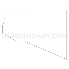
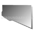
Outline
Summary
| Unique Area Identifier | 581480 |
| Name | WATERLOO W4P6 |
| County | Black Hawk County |
| State | Iowa |
| Area (square miles) | 2.43 |
| Land Area (square miles) | 2.43 |
| Water Area (square miles) | 0.00 |
| % of Land Area | 100.00 |
| % of Water Area | 0.00 |
| Latitude of the Internal Point | 42.48945070 |
| Longtitude of the Internal Point | -92.28578280 |
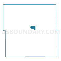
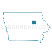
Maps

Graphs
Select a template below for downloading or customizing gragh for WATERLOO W4P6, Black Hawk County, Iowa


Neighbors
Neighoring Voting District (by Name) Neighboring Voting District on the Map
- EVANSDALE Voting District, Black Hawk County, IA
- POYNER PCT 1/EAST WATERLOO TWP, Black Hawk County, IA
- WATERLOO W4P4, Black Hawk County, IA
- WATERLOO W4P5, Black Hawk County, IA
Top 10 Neighboring County Subdivision (by Population) Neighboring County Subdivision on the Map
- Waterloo city, Black Hawk County, IA (68,406)
- Evansdale city, Black Hawk County, IA (4,751)
- East Waterloo township, Black Hawk County, IA (1,395)